Hurricane Marie Swell Floods Orange County Coastline
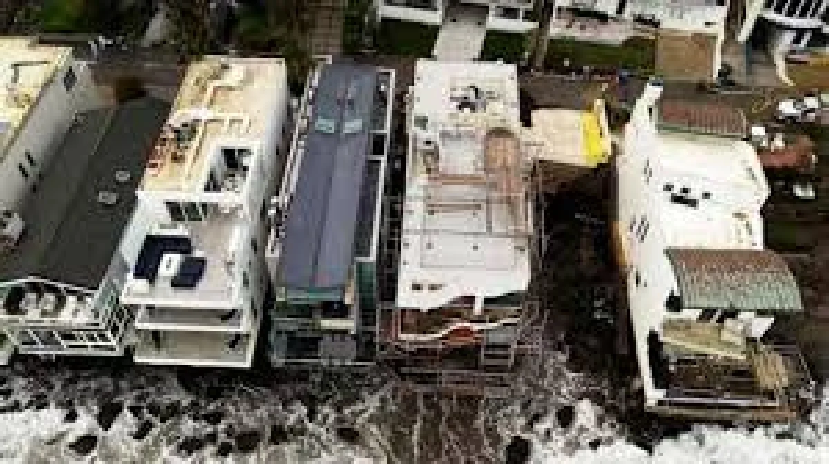
A powerful swell generated by Hurricane Marie struck the Orange County coastline on 7 September, driving floodwater and sand into streets, damaging homes and vehicles, and carving beaches back so sharply that fresh cliff edges appeared where flat sand had once stretched to the sea. The swell was estimated at 8 to 10 feet, a size that pushed the ocean far enough inland to leave roads coated, bury drains and force property owners to confront damage that had nothing to do with rain.
The event unfolded in a single day, but its effects are not confined to a single day. Sand that rushed ashore must be cleared from streets before normal traffic can move freely again. Homes and vehicles that took on water and grit need assessment and repair. Along parts of the shoreline, the beach itself has been reshaped, with steep drops replacing gentle slopes and older material, hidden for years beneath the sand, suddenly sitting in open air.
A Single Day That Redrew the Shoreline
The sequence was straightforward and fast. Hurricane Marie, spinning far out over warm ocean water, generated a long-period swell that travelled thousands of miles before it reached Southern California’s coast. On 7 September, that energy arrived at Orange County’s beaches. The result was flooding along the shore and erosion that cut into the beach face, removing sand in volumes large enough to expose what lay beneath.
Eight to Ten Feet of Swell
An 8-to-10-foot swell is not the tallest surf Southern California ever sees, but height alone does not determine damage. What matters is the combination of wave height, the interval between waves, and the direction from which the swell arrives. Long-interval swells carry more energy and push water higher up the beach with each set, and when a sustained train of such waves arrives, the shoreline absorbs the impact for hours rather than minutes. That is the mechanism that turned a distant hurricane into a local emergency.
Sand Where Roads Should Be
Water and sand moved together through the coastal zone. Streets were left covered with a layer of sand, and flooding pushed grit around damaged properties. Vehicles parked near the water were caught in the surge. Homes took on water and debris. The practical disruption, residents said, was immediate: driveways blocked, access routes compromised, and cleanup work that began the moment the water receded.
For Residents, Damage Was Practical and Immediate
Coastal erosion can sound like an abstract planning concern until it reaches the places people use every day. In this case it did. The damage extended past the tideline and onto residential streets, which means the recovery burden falls on households rather than only on public agencies. Sand has to be removed from roads. Damaged vehicles need repair or replacement. Homes need inspection for water intrusion and structural damage.
Residents also described the erosion as unusually severe for their stretch of coast. Beach loss is a familiar seasonal rhythm in Orange County, but the scale reported here, with beach faces sharpened into cliff edges over the course of a day, stood out even to people accustomed to seeing the shoreline change.
Why Orange County’s Coast Takes the Hit
Orange County’s coastline runs from Seal Beach in the north through Huntington Beach, Newport Beach, Laguna Beach and down toward Dana Point and San Clemente. Much of it is a combination of wide sandy beaches, engineered harbours, jetties and rocky coves. That variety matters, because different stretches respond to wave energy in different ways: a long, open beach may lose sand steadily across its width, while a bluff-backed cove can see material stripped away to reveal rock and buried structures.
A Coastline Built on Shifting Sand
Southern California beaches are essentially reservoirs of sand, constantly fed and depleted by waves, currents, tides and storms. Winter swells typically pull sand offshore, and calmer summer conditions push it back. When an unusual swell arrives, the balance tips, and the beach can lose ground quickly. Because the sand is the protective layer between the ocean and whatever sits behind it, losing that layer accelerates every other problem, from flooding to structural exposure.
Buried Infrastructure Comes Back into View
Where sand was stripped away, old asphalt, pipes and pieces of an old pier emerged. Those objects are a useful measure of how much material had shifted: what the ocean uncovered had been buried deep enough that no one expected to see it. Exposed pipelines and forgotten road surfaces can be hazardous in themselves, and they also signal that the natural buffer protecting nearby homes and roads has thinned considerably.
Severity, Not Erosion, Is the Real Story
Local people were clear that erosion is common along their coast. That context is what gives the event its meaning. The notable element is not that the beach changed, but how much it changed, and how far the consequences travelled inland. An 8-to-10-foot swell produced damage severe enough to uncover infrastructure remnants and leave streets and private property coated in sand, all within a single day.
Elsewhere in the news cycle, attention shifts quickly from one story to the next, from the naming of a new school leader such as the Burke High appointment to distant geopolitical developments like Israel’s recognition of Somaliland. Coastal communities, however, do not get to move on so easily. Their recovery is measured in loads of sand hauled off streets and insurance claims filed over water-damaged homes.
Hurricane Marie and the Wider Pattern of Pacific Swells
Hurricanes in the eastern Pacific rarely make landfall in California, but they do not need to. Storms that intensify off Mexico’s coast regularly send groundswell north-eastward toward the United States, and the results can be dramatic even under clear skies. The name Marie has appeared on eastern Pacific storm lists for years and is remembered in California for a 2014 episode in which an intense hurricane far to the south helped produce record-setting surf along the state’s beaches, damaging structures and prompting rescues.
The report cited here does not specify a year beyond the 7 September date, but the mechanism it describes fits a familiar pattern: a distant storm, a long-travelling swell, and a coastline absorbing energy it was not shaped to handle. Warming ocean temperatures and shifting storm tracks are increasingly part of the conversation among coastal planners, who note that high-energy swell events can interact with elevated sea levels to push water further inland than similar events would have done in the past.
Cleanup and Recovery: Not a One-Day Task
What comes next is a recovery problem. Sand must be cleared from streets before ordinary use can resume. Damaged homes and vehicles need attention before their owners can return to routine. Where cliff edges formed, the shoreline remains altered, and the exposed asphalt, pipes and pier fragments linger as visible evidence of how much ground was lost.
Public agencies typically face a sequence of tasks after such an event: clearing roads, checking drainage and flood control channels, assessing whether exposed utilities pose a risk, and evaluating whether the beach needs sand replenishment. Private property owners face their own sequence, from documentation of damage to coordination with insurers. Neither process moves as quickly as the ocean did.
What the Event Means for Coastal Residents
For anyone living along Orange County’s coast, the practical takeaway is blunt. This was not routine beach reshaping driven by ordinary seasonal change. It was a strong swell that pushed floodwater and sand far enough inland to damage property and redraw parts of the beach in a single day, exposing infrastructure that had been buried for years.
The lesson is about preparation and vigilance. Distant hurricanes can deliver local damage without a drop of rain, and the warning signs arrive days in advance through surf advisories and swell forecasts. Residents who treat those notices seriously, moving vehicles, securing loose items and staying clear of low-lying shorelines, reduce the odds of joining the damage tally the next time a long-travelling swell arrives at the coast.
Source Reference (el-balad.com): Hurricane Marie Swell Drives Orange County California Flooding, Erosion
